
How we manage risk and plan resources
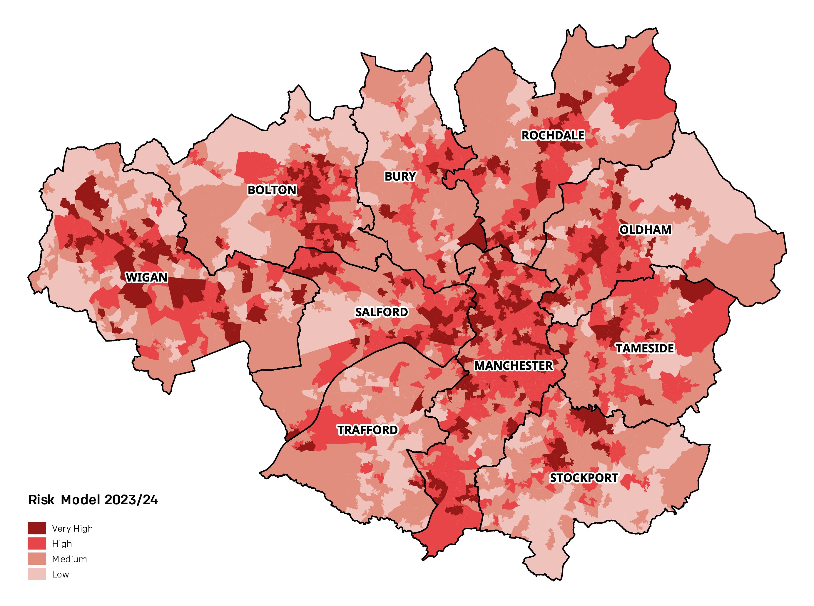
To enable us to create an accurate risk profile of our communities, we undertake an annual Strategic Assessment of Risk (SAoR) that helps us to consider the impact of external factors that may be a risk to our communities and how we need to respond. This also enables us to create risk profiles of each borough, which are used alongside the SAoR to determine where our resources should be located and underpin our decisions. The map shows the predominant risk levels of the areas within each of our 10 districts.
Using this information we develop initial proposals that are analysed and evaluated using our Workload Modelling process that assesses the impact of changes based on historical data and predetermined attendance rules. A base model is created and options are tested against it, with results compared using measures such as response time, pump utilisation, and performance against our 10-minute planning standard.
Options are then narrowed down considering any impacts on crewing, special appliances, training, prevention and protection delivery, and financial implications, leading to the final proposals.
Response standards
We measure our performance when responding to incidents using our response planning standard, which is to respond to all life-risk incidents within 10 minutes from the receipt of the emergency call at North West Fire Control (NWFC) on 80% of occasions.
The measure includes call handling time at NWFC, time for our crews to ‘turn out’ the fire engine, put on their personal protective equipment (PPE), and includes travel time to the incident location.
We aim to respond more quickly than this and our target response time to life-risk emergencies is 7 minutes 30 seconds. As of May 2023, our performance is even quicker at 7 minutes 21 seconds. However, we always aim to respond to an incident in the shortest time possible and in as safe a manner as possible.
Current fire cover arrangements
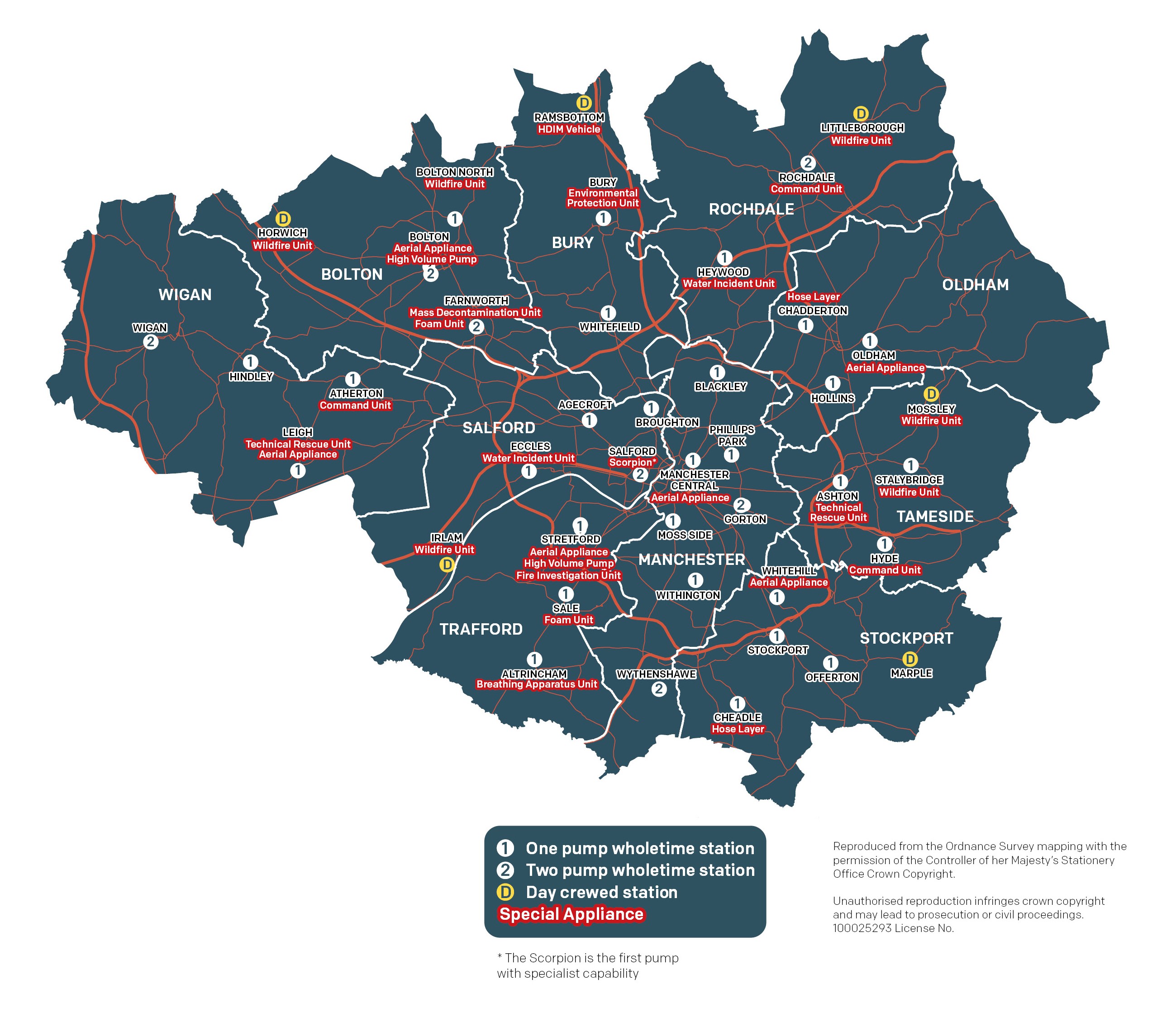
GMFRS fire engines and firefighters are strategically located across Greater Manchester based on where there are greater risks and a greater number of calls. Though our resources are based in certain locations, they move across Greater Manchester as and when needed to ensure our fire engines arrive at incidents as quickly as possible.
We currently operate two crewing systems – a ‘wholetime’ shift duty system and day crewing, ensuring firefighters are available 24/7 365 days per year and can be quickly mobilised to incidents.
We also have a number of specialist appliances strategically located provide a variety of capabilities to resolve the vast array of incident scenarios we face.
Additional documents
Station resource profiles (Word, 3.93MB)